

Lamanda Park
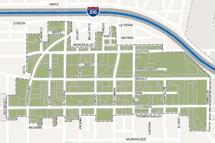
The Lamanda Park Specific Plan (LPSP) was adopted by City Council on November 18, 2024. The Specific Plan generally encompasses the area between the 210 freeway to the north, Roosevelt and Vista Avenues to the west, Colorado Boulevard to the south and Kinneloa Avenue to the east.
The Sierra Madre Villa Station is located just east of the plan area, serving the Metro A Line.
Plan Area Map
Lamanda Park's vision is to be a research and development hub with light industrial and creative businesses supported by flexible commercial spaces and diverse housing opportunities near jobs, shops, and services connected by a vibrant public realm. The plan encourages the continued development of these uses while introducing more housing opportunities along the peripheries. Implementation actions are part of the plan that are intended to guide and prioritize public realm improvements to achieve the plan vision over time.